 1
 2
 3
 4
 5
 6
 7
 8
 9
10
11
12
13
14
15
16
17
18
19
20
21
22
23
24
25
26
27
28
29
30
31
32
33
34
35
36
37
38
39
40
41
42
43
44
45
46
47
48
49
50
51
52
53
54
55
56
57
58
59
60
61
62
63
64
65
66
67
68
69
70
71
72
73
74
75
76
77
78
79
80
81
82
83
84
85
86
87
88
89
90
91
92
93
94
95
96
97
98
99
100
101
102
103
104
105
106
107
108
109
110
111
112
113
114
115
116
117
118
119
120
121
122
123
124
125
126
127
128
129
130
131
132
133
134
135
136
137
138
139
140
141
142
143
144
145
146
147
148
149
150
151
152
153
154
155
156
157
158
159
160
161
162
163
164
165
166
167
168
169
170
171
172
173
174
175
176
177
178
179
180
181
182
183
184
185
186
187
188
189
190
191
192
193
194
195
196
197
198
199
200
201
202
203
204
205
206
207
208
209
210
211
212
213
214
215
216
217
218
219
220
221
222
223
224
225
226
227
228
229
230
231
232
233
234
235
236
237
238
239
240
241
242
243
244
245
246
247
248
249
250
251
252
253
254
255
256
257
258
259
260
261
262
263
264
265
266
267
268
269
270
271
272
273
274
275
276
277
278
279
280
281
282
283
284
285
286
287
288
289
290
291
292
293
294
295
296
297
298
299
300
301
302
303
304
305
306
307
308
309
310
311
312
313
314
315
316
317
318
319
320
321
322
323
324
325
326
327
328
329
330
331
332
333
334
335
336
337
338
339
340
341
342
343
344
345
346
347
348
349
350
351
352
353
354
355
356
357
358
359
360
361
362
363
364
365
366
367
368
369
370
371
372
373
374
375
376
377
378
379
380
381
382
383
384
385
386
387
388
389
390
391
392
393
394
395
396
397
398
399
400
401
402
403
404
405
406
407
408
409
410
411
412
413
414
415
416
417
418
419
420
421
422
423
424
425
426
427
428
429
430
431
432
433
434
435
436
437
438
439
440
441
442
443
444
445
446
447
448
449
450
451
452
453
454
455
456
457
458
459
460
461
462
463
464
465
466
467
468
469
470
471
472
473
474
475
476
477
478
479
480
481
482
483
484
485
486
487
488
489
490
491
492
493
494
495
496
497
498
499
500
501
502
503
504
505
506
507
508
509
510
511
512
513
514
515
516
517
518
519
520
521
522
523
524
525
526
527
528
529
530
531
532
533
534
535
536
537
538
539
540
541
542
543
544
545
546
547
548
549
550
551
552
553
554
555
556
557
558
559
560
561
562
563
564
565
566
567
568
569
570
571
572
573
574
575
576
577
578
579
580
581
582
583
584
585
586
587
588
589
590
591
592
593
594
595
596
597
598
599
600
601
602
|
import os
import math
import shapefile
import tarfile
import time, shutil
from shapely import geometry
from itertools import tee
import networkx as nx
import cv2
from osgeo import ogr, osr, gdal, gdalconst
import numpy as np
from skimage.segmentation import slic
from skimage import morphology
import geopandas as gpd
from pathlib import Path
import topojson as tp
def create_mask(input_arra):
mask = morphology.remove_small_holes(morphology.remove_small_objects(input_arra > 0, 500),500)
mask = morphology.opening(mask, morphology.disk(3))
return mask
def untar(fname, dirs):
''' 解压缩tar文件函数 '''
t = tarfile.open(fname)
t.extractall(path=dirs)
def write_img(filename, im_proj, im_geotrans, im_data):
if 'int8' in im_data.dtype.name:
datatype = gdal.GDT_Byte
elif 'int16' in im_data.dtype.name:
datatype = gdal.GDT_UInt16
else:
datatype = gdal.GDT_Float32
if len(im_data.shape) >= 3:
im_height , im_width, im_bands = im_data.shape
else:
im_height, im_width = im_data.shape
im_bands = 1
driver = gdal.GetDriverByName("GTiff")
dataset = driver.Create(filename, im_width, im_height, im_bands, datatype)
dataset.SetGeoTransform(im_geotrans)
dataset.SetProjection(im_proj)
if im_bands == 1:
dataset.GetRasterBand(1).WriteArray(im_data)
else:
for i in range(im_bands):
dataset.GetRasterBand(i + 1).WriteArray(im_data[i+1])
del dataset
def merge_mean_color(graph, src, dst):
graph.nodes[dst]['total color'] += graph.nodes[src]['total color']
graph.nodes[dst]['pixel count'] += graph.nodes[src]['pixel count']
graph.nodes[dst]['mean color'] = (graph.nodes[dst]['total color'] /
graph.nodes[dst]['pixel count'])
def segementation_img(input_raster, output_raster):
dataset = gdal.Open(input_raster)
im_width = dataset.RasterXSize
im_height = dataset.RasterYSize
im_geotrans = dataset.GetGeoTransform()
im_proj = dataset.GetProjection()
im_data = dataset.ReadAsArray(0, 0, im_width, im_height) #0, 0, im_width, im_height
bandnum = dataset.RasterCount
im_data = im_data.astype(int)
if bandnum == 1:
temp, mask_arra = im_data.transpose((1,0))
elif bandnum == 2:
im_data = im_data[0]
temp, mask_arra = im_data.transpose((1,0))
else:
im_data = im_data[0:3]
temp = im_data.transpose((2, 1, 0))
mask_arra = temp[:, : , 0]
mask = create_mask(mask_arra)
seg_func = slic(temp, n_segments=2000, compactness=10, mask=mask) #1
#seg_func = quickshift(temp, ratio=1.0, kernel_size=5)
label = seg_func.transpose((1,0))
write_img(output_raster, im_proj, im_geotrans, label)
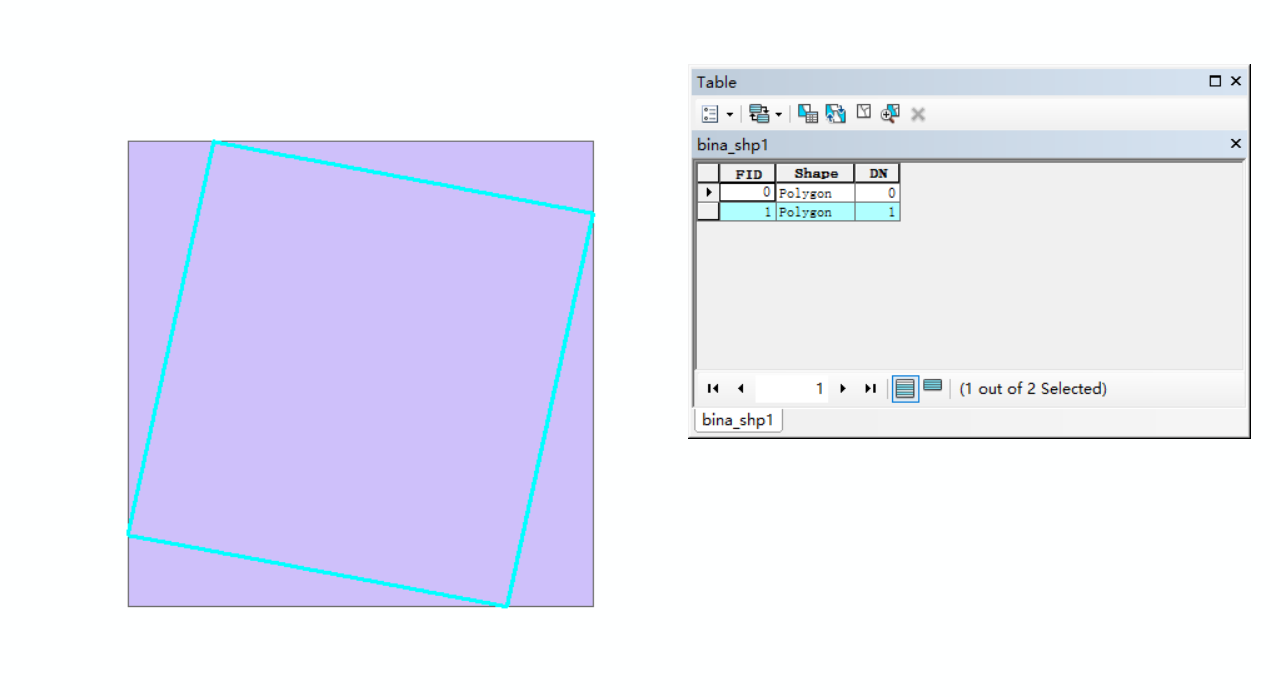
def PolygonizeTheRaster_bina(inputfile,outputfile):
dataset = gdal.Open(inputfile, gdal.GA_ReadOnly)
srcband=dataset.GetRasterBand(1)
im_proj = dataset.GetProjection()
prj = osr.SpatialReference()
prj.ImportFromWkt(im_proj)
drv = ogr.GetDriverByName('ESRI Shapefile')
dst_ds = drv.CreateDataSource(outputfile)
dst_layername = 'out'
dst_layer = dst_ds.CreateLayer(dst_layername, srs=prj)
dst_fieldname = 'DN'
fd = ogr.FieldDefn(dst_fieldname, ogr.OFTInteger)
dst_layer.CreateField(fd)
dst_field = 0
gdal.Polygonize(srcband, None, dst_layer, dst_field)
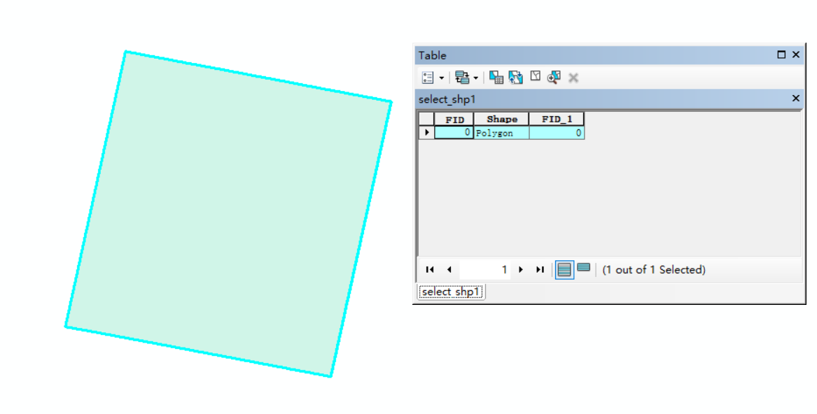
def SelectByAttribute(InShp, outShp):
open_parks = ogr.Open(InShp)
layer_park = open_parks.GetLayer(0)
layer_park.SetAttributeFilter("DN = '1'")
number_park = layer_park.GetFeatureCount()
driver = ogr.GetDriverByName("ESRI shapefile")
if os.path.exists(outShp):
driver.DeleteDataSource(outShp)
dataset = driver.CreateDataSource(outShp)
spatialref_new = osr.SpatialReference()
spatialref_new.ImportFromEPSG(4326)
new_layer = dataset.CreateLayer(outShp, geom_type= ogr.wkbPolygon, srs=spatialref_new)
for j in range(0, number_park):
h = layer_park.GetNextFeature()
new_layer.CreateFeature(h)
dataset.Destroy()
def raster_binary(input_raster,out_raster):
    dataset = gdal.Open(input_raster)
    im_width = dataset.RasterXSize
    im_height = dataset.RasterYSize
    im_geotrans = dataset.GetGeoTransform()
    im_proj = dataset.GetProjection()
    im_data = dataset.ReadAsArray(0, 0, im_width, im_height)
    # re0 = im_data.transpose((2, 1, 0))
    ret, border0 = cv2.threshold(im_data[0], 0, 1, cv2.THRESH_BINARY)
    # border0 = border0.transpose((2, 1, 0))
    write_img(out_raster, im_proj, im_geotrans, border0)
    del dataset
def PolygonizeTheRaster(inputfile,outputfile):
dataset = gdal.Open(inputfile, gdal.GA_ReadOnly)
srcband=dataset.GetRasterBand(1)
im_proj = dataset.GetProjection()
im_trans = dataset.GetGeoTransform()
tolerance = im_trans[1]*5
prj = osr.SpatialReference()
prj.ImportFromWkt(im_proj)
drv = ogr.GetDriverByName('ESRI Shapefile')
dst_ds = drv.CreateDataSource(outputfile)
dst_layername = 'out'
dst_layer = dst_ds.CreateLayer(dst_layername, srs=prj)
dst_fieldname = 'DN'
fd = ogr.FieldDefn(dst_fieldname, ogr.OFTInteger)
dst_layer.CreateField(fd)
dst_field = 0
gdal.Polygonize(srcband, None, dst_layer, dst_field)
return tolerance
def pol2line(polyfn, linefn):
"""
This function is used to make polygon convert to line
:param polyfn: the path of input, the shapefile of polygon
:param linefn: the path of output, the shapefile of line
:return:
"""
driver = ogr.GetDriverByName('ESRI Shapefile')
polyds = ogr.Open(polyfn, 0)
polyLayer = polyds.GetLayer()
spatialref = polyLayer.GetSpatialRef()
if os.path.exists(linefn):
driver.DeleteDataSource(linefn)
lineds =driver.CreateDataSource(linefn)
linelayer = lineds.CreateLayer(linefn, srs=spatialref, geom_type=ogr.wkbLineString)
featuredefn = linelayer.GetLayerDefn()
for feat in polyLayer:
geom = feat.GetGeometryRef()
ring = geom.GetGeometryRef(0)
outfeature = ogr.Feature(featuredefn)
outfeature.SetGeometry(ring)
linelayer.CreateFeature(outfeature)
outfeature = None
def waibao(inShapefile, outShapefile):
inDriver = ogr.GetDriverByName("ESRI Shapefile")
inDataSource = inDriver.Open(inShapefile, 0)
inLayer = inDataSource.GetLayer()
geomcol = ogr.Geometry(ogr.wkbGeometryCollection)
for feature in inLayer:
geomcol.AddGeometry(feature.GetGeometryRef())
convexhull = geomcol.ConvexHull()
outDriver = ogr.GetDriverByName("ESRI Shapefile")
if os.path.exists(outShapefile):
outDriver.DeleteDataSource(outShapefile)
outDataSource = outDriver.CreateDataSource(outShapefile)
outLayer = outDataSource.CreateLayer("test_convexhull", geom_type=ogr.wkbPolygon)
idField = ogr.FieldDefn("id", ogr.OFTInteger)
outLayer.CreateField(idField)
featureDefn = outLayer.GetLayerDefn()
feature = ogr.Feature(featureDefn)
feature.SetGeometry(convexhull)
feature.SetField("id", 1)
outLayer.CreateFeature(feature)
feature = None
inDataSource = None
outDataSource = None
def get_differ_shp(input_main,input_minor,output_differ):
gdf_main = gpd.read_file(input_main)
gdf_minor = gpd.read_file(input_minor)
gdf_differ= gpd.overlay(gdf_main,gdf_minor,'difference')
gdf_differ.to_file(output_differ)
def get_intersect_shp(out_shp_ring1 , out_shp_ring2, outshp_intersect):
    gdf_left = gpd.read_file(out_shp_ring1)
    gdf_right = gpd.read_file(out_shp_ring2)
    gdf_intersect = gpd.overlay(gdf_left,gdf_right,'intersection',keep_geom_type=True)
    gdf_intersect.to_file(outshp_intersect)
def clip_raster_from_intersect(input_main_raster, input_shp, output_raster):
    input_raster=gdal.Open(input_main_raster)
    ds = gdal.Warp(output_raster,
                input_raster,
                format = 'GTiff',
                cutlineDSName = input_shp,
                cutlineWhere="FIELD = 'whatever'",
                dstNodata = -9999)
    ds=None
def get_start_end_points(intersect_shp, out_shp_point):
inDriver = ogr.GetDriverByName("ESRI Shapefile")
inDataSource = inDriver.Open(intersect_shp, 0)
inLayer = inDataSource.GetLayer()
extent = inLayer.GetExtent()
elon = abs( extent[0] - extent[1] )
elat = abs( extent[2] - extent[3] )
if elat> elon:
start = geometry.Point(extent[0],extent[2])
end = geometry.Point(extent[1], extent[3])
else:
start = geometry.Point(extent[1], extent[2])
end = geometry.Point(extent[0], extent[3])
pointshp = gpd.GeoSeries([start, end],
crs='EPSG:4326',
index=['0', '1']
)
pointshp.to_file(out_shp_point,driver='ESRI Shapefile',encoding='utf-8')
inDataSource = None
out_shp_point = None
def BetterMedianFilter(src_arr, k = 3, padding = None):
height, width = src_arr.shape
if not padding:
edge = int((k-1)/2)
if height - 1 - edge <= edge or width - 1 - edge <= edge:
print("The parameter k is to large.")
return None
new_arr = np.zeros((height, width), dtype = "uint16")
for i in range(height):
for j in range(width):
if i <= edge - 1 or i >= height - 1 - edge or j <= edge - 1 or j >= height - edge - 1:
new_arr[i, j] = src_arr[i, j]
else:
nm = src_arr[i - edge:i + edge + 1, j - edge:j + edge + 1]
max = np.max(nm)
min = np.min(nm)
if src_arr[i, j] == max or src_arr[i, j] == min:
new_arr[i, j] = np.median(nm)
else:
new_arr[i, j] = src_arr[i, j]
return new_arr
def haversine(n0, n1):
x1, y1 = n0
x2, y2 = n1
x_dist = math.radians(x1 - x2)
y_dist = math.radians(y1 - y2)
y1_rad = math.radians(y1)
y2_rad = math.radians(y2)
a = math.sin(y_dist/2)**2 + math.sin(x_dist/2)**2 \
* math.cos(y1_rad) * math.cos(y2_rad)
c = 2 * math.asin(math.sqrt(a))
distance = c * 6371
return distance
def pairwise(iterable):
"""返回可迭代访问的二值元组
s -> (s0,s1), (s1,s2), (s2, s3), ..."""
a, b = tee(iterable)
next(b, None)
return zip(a, b)
def shortest_path_dijsktra(input_road_shp, input_point_shp, outpath):
driver = ogr.GetDriverByName('ESRI Shapefile')
G = nx.DiGraph()
r1 = shapefile.Reader(input_road_shp)
for s in r1.shapes():
for p1, p2 in pairwise(s.points):
G.add_edge(tuple(p1), tuple(p2))
sg = list(G.to_undirected(c) for c in nx.strongly_connected_components(G))[0]
r2 = shapefile.Reader(input_point_shp)
start = r2.shape(0).points[0]
end = r2.shape(1).points[0]
for n0, n1 in sg.edges():
dist = haversine(n0, n1)
sg.edges[n0,n1]["dist"] = dist
nn_start = None
nn_end = None
start_delta = float("inf")
end_delta = float("inf")
for n in sg.nodes():
s_dist = haversine(start, n)
e_dist = haversine(end, n)
if s_dist < start_delta:
nn_start = n
start_delta = s_dist
if e_dist < end_delta:
nn_end = n
end_delta = e_dist
nx.shortest_path
path = nx.astar_path(sg, source=nn_start, target=nn_end, weight="dist") #list , method="bellman-ford"
multiline = ogr.Geometry(ogr.wkbMultiLineString)
line = ogr.Geometry(ogr.wkbLineString)
print(start[0], start[1])
line.AddPoint(start[0], start[1])
for point in path:
print(point[0], point[1])
line.AddPoint(point[0],point[1]) # 添加点01
print(end[0])
print(end[1])
line.AddPoint(end[0], end[1])
multiline.AddGeometry(line)
wkt = multiline.ExportToWkt()
driver = ogr.GetDriverByName("ESRI Shapefile")
data_source = driver.CreateDataSource(outpath)
srs = osr.SpatialReference()
srs.ImportFromEPSG(4326)
layer = data_source.CreateLayer("path", srs, ogr.wkbLineString )
field_name = ogr.FieldDefn("Name", ogr.OFTString)
field_name.SetWidth(14)
layer.CreateField(field_name)
field_name = ogr.FieldDefn("data", ogr.OFTString)
field_name.SetWidth(14)
layer.CreateField(field_name)
feature = ogr.Feature(layer.GetLayerDefn())
feature.SetField("Name", "path")
line = ogr.CreateGeometryFromWkt(wkt)
feature.SetGeometry(line)
layer.CreateFeature(feature)
feature = None
data_source = None
def simplifyshp(input, output): #容差是分辨率的根号二倍
gdf_main = gpd.read_file(input)
simp = gdf_main.simplify(tolerance=0.001, preserve_topology=True)
simp.to_file(output)
def merge_all_feature_in_one(input, output):
gdf = gpd.read_file(input)
geom = gdf['geometry']
new_geom = gpd.tools.collect(geom)
df = {'id': [0], 'geometry': [new_geom]}
new_gdf = gpd.GeoDataFrame(df, crs="EPSG:4326")
new_gdf.to_file(output)
def get_non_building_field_raster(input,output):
np.seterr(invalid='ignore')
dataset = gdal.Open(input)
im_geotrans = dataset.GetGeoTransform()
im_proj = dataset.GetProjection()
im_width = dataset.RasterXSize
im_height = dataset.RasterYSize
im_data = dataset.ReadAsArray(0, 0, im_width, im_height)
im_data = im_data.astype(np.float64)
ndvi = (im_data[3] - im_data[2]) / (im_data[3] + im_data[2])
slics =np.where( ndvi > -0.1, ndvi * 1, 0)
write_img(output, im_proj, im_geotrans, slics)
del dataset
def collect_non_builidng_shp(input, output):
nonbuilding = gpd.read_file(input)
selec = nonbuilding[nonbuilding.DN == 1]
selec.to_file(output, driver="ESRI Shapefile")
def RasterMosaic(inputfilePath, referencefilefilePath, outputfile, outputfile2, cutline):
inputrasfile1 = gdal.Open(inputfilePath, gdal.GA_ReadOnly) # 第一幅影像
inputProj1 = inputrasfile1.GetProjection()
inputrasfile2 = gdal.Open(referencefilefilePath, gdal.GA_ReadOnly) # 第二幅影像
options=gdal.WarpOptions(srcSRS=inputProj1,
dstSRS=inputProj1,
format='GTiff',
resampleAlg=gdalconst.GRA_Bilinear,
srcNodata=0,
dstNodata=0,
cutlineDSName=cutline
)
options2=gdal.WarpOptions(srcSRS=inputProj1,
dstSRS=inputProj1,
format='GTiff',
resampleAlg=gdalconst.GRA_Bilinear,
srcNodata=0,
dstNodata=0
)
gdal.Warp(outputfile,inputrasfile1,options=options)
gdal.Warp(outputfile2, [inputrasfile2,outputfile], options=options2)
def buildpyramid(input):
Image = gdal.Open(input, 0) # 0 = read-only, 1 = read-write.
gdal.SetConfigOption('COMPRESS_OVERVIEW', 'DEFLATE')
Image.BuildOverviews('NEAREST', [4, 8, 16, 32, 64, 128], gdal.TermProgress_nocb)
del Image # close the dataset (Python object and pointers)
def buffer(inShp, out, value):
"""
:param inShp: 输入的矢量路径
:param fname: 输出的矢量路径
:param bdistance: 缓冲区距离
:return:
"""
ogr.UseExceptions()
in_ds = ogr.Open(inShp)
in_lyr = in_ds.GetLayer()
driver = ogr.GetDriverByName('ESRI Shapefile')
if Path(out).exists():
driver.DeleteDataSource(out)
out_ds = driver.CreateDataSource(out)
out_lyr = out_ds.CreateLayer(out, in_lyr.GetSpatialRef(), ogr.wkbPolygon)
def_feature = out_lyr.GetLayerDefn()
for feature in in_lyr:
geometry = feature.GetGeometryRef()
buffer = geometry.Buffer(value)
out_feature = ogr.Feature(def_feature)
out_feature.SetGeometry(buffer)
out_lyr.CreateFeature(out_feature)
out_feature = None
out_ds.FlushCache()
del in_ds, out_ds
def explord(input,output , output_temp):
gdf_main = gpd.read_file(input)
explord = gpd.GeoDataFrame.explode(gdf_main)
explord.to_file(output_temp, driver="ESRI Shapefile")
output_temp_shp = gpd.read_file(output_temp)
areas = output_temp_shp.area
index = areas.sort_values(ascending = False).index.tolist()[0]
row = output_temp_shp.loc[[index]]
row.to_file(output, driver="ESRI Shapefile")
def resample_for_seg(input_Dir, output_dir):
    dataset = gdal.Open(input_Dir, gdal.GA_ReadOnly)
    ds_trans = dataset.GetGeoTransform()
    res = ds_trans[1]*2
    gdal.Translate(output_dir, input_Dir, xRes=res, yRes=res, resampleAlg="bilinear", format="GTiff")
def topo_simplify(input, output, tolerance):
    gdf = gpd.read_file(input)
    topo = tp.Topology(gdf, prequantize=False)
    gdf = topo.toposimplify(tolerance).to_gdf()
    gdf.to_file(output, driver="ESRI Shapefile")
def main(input1, input2, output):
time_start=time.time()
print("start deal")
tempdir = os.path.join(os.path.dirname(output),"temp")
try:
os.mkdir(tempdir)
except Exception as e:
pass
out_raster1 = os.path.join(tempdir,"out_raster1.tif")
out_raster2 = os.path.join(tempdir,"out_raster2.tif")
outputfile1 = os.path.join(tempdir,"bina_shp1.shp")
outputfile2 = os.path.join(tempdir,"bina_shp2.shp")
outShp1 = os.path.join(tempdir,"select_shp1.shp")
outShp2 = os.path.join(tempdir,"select_shp2.shp")
outshp_intersect = os.path.join(tempdir,"intersect_shp.shp")
inter_sim_shp = os.path.join(tempdir,"intersect_simply_shp.shp")
output_raster = os.path.join(tempdir,"clip_interest_raster.tif")
resample_raster = os.path.join(tempdir,"clip_resample_raster.tif")
out_shp_point = os.path.join(tempdir,"start_end_point.shp")
seg_raster = os.path.join(tempdir,"seg_raster.tif")
seg_poly = os.path.join(tempdir,"seg_poly_shp.shp")
seg_line = os.path.join(tempdir,"seg_line_shp.shp")
seg_line_sim = os.path.join(tempdir,"seg_line_sim.shp")
seg_line_mer_inter = os.path.join(tempdir,"seg_line_mer_inter_shp.shp")
intersect_buffer = os.path.join(tempdir,"intersect_buffer.shp")
seg_line_mer = os.path.join(tempdir,"seg_line_mer.shp")
# simplify_seg_line = os.path.join(tempdir,"sim_seg_line.shp")
shortestpath = os.path.join(tempdir,"shortestpath.shp")
bufferline = os.path.join(tempdir,"cutline_buffer.shp")
mosaic_mask_clip = os.path.join(tempdir,"mosaic_mask1.shp")
mosaic_mask_true = os.path.join(tempdir,"mosaic_mask_true.shp")
mask_temp = os.path.join(tempdir,"mask_temp.shp")
mask_raster = os.path.join(tempdir,"mask_raster.tif")
buffer_line = os.path.join(tempdir,"buffer_line.shp")
raster_binary(input1,out_raster1)
raster_binary(input2,out_raster2)
PolygonizeTheRaster_bina(out_raster1,outputfile1)
PolygonizeTheRaster_bina(out_raster2,outputfile2)
print("Binarize done")
SelectByAttribute(outputfile1, outShp1)
SelectByAttribute(outputfile2, outShp2)
get_intersect_shp(outShp1 , outShp2, outshp_intersect)
simplifyshp(outshp_intersect, inter_sim_shp)
print("Simplify done")
clip_raster_from_intersect(input1, inter_sim_shp, output_raster)
resample_for_seg(output_raster, resample_raster)
start2 = time.time()
print("Start segment")
segementation_img(resample_raster, seg_raster)
end2 = time.time()
print('seg time cost',end2-start2,'s')
print("Segment done")
tolerance = PolygonizeTheRaster(seg_raster,seg_poly)
pol2line(seg_poly, seg_line)
topo_simplify(seg_line, seg_line_sim, tolerance)
merge_all_feature_in_one(seg_line_sim,seg_line_mer)
get_intersect_shp(seg_line_mer , outshp_intersect, seg_line_mer_inter)
print("Polygonized done")
buffer(outshp_intersect, intersect_buffer, -0.00005)
get_intersect_shp(seg_line_mer_inter , intersect_buffer, buffer_line)
get_start_end_points(inter_sim_shp, out_shp_point)
print("start to find shortest path")
shortest_path_dijsktra(buffer_line, out_shp_point, shortestpath)
print("Find shortest path done")
buffer(shortestpath, bufferline, 0.000000001)
get_differ_shp(outShp1, bufferline, mosaic_mask_clip)
explord(mosaic_mask_clip, mosaic_mask_true, mask_temp)
RasterMosaic(input1, input2, mask_raster, output, mosaic_mask_true)
print("Mosaic done")
time_end=time.time()
print('time cost',time_end-time_start,'s')
#shutil.rmtree(tempdir)
buildpyramid(outputfile)
if __name__ == "__main__":
input1 = r"D:\Data\testdata\mosaic\orthx\orthx1.tif"
input2 = r"D:\Data\testdata\mosaic\orthx\orthx2.tif"
outputfile = r"D:\Data\testdata\mosaic\mosaic.tif"
main(input1,input2,outputfile)
|

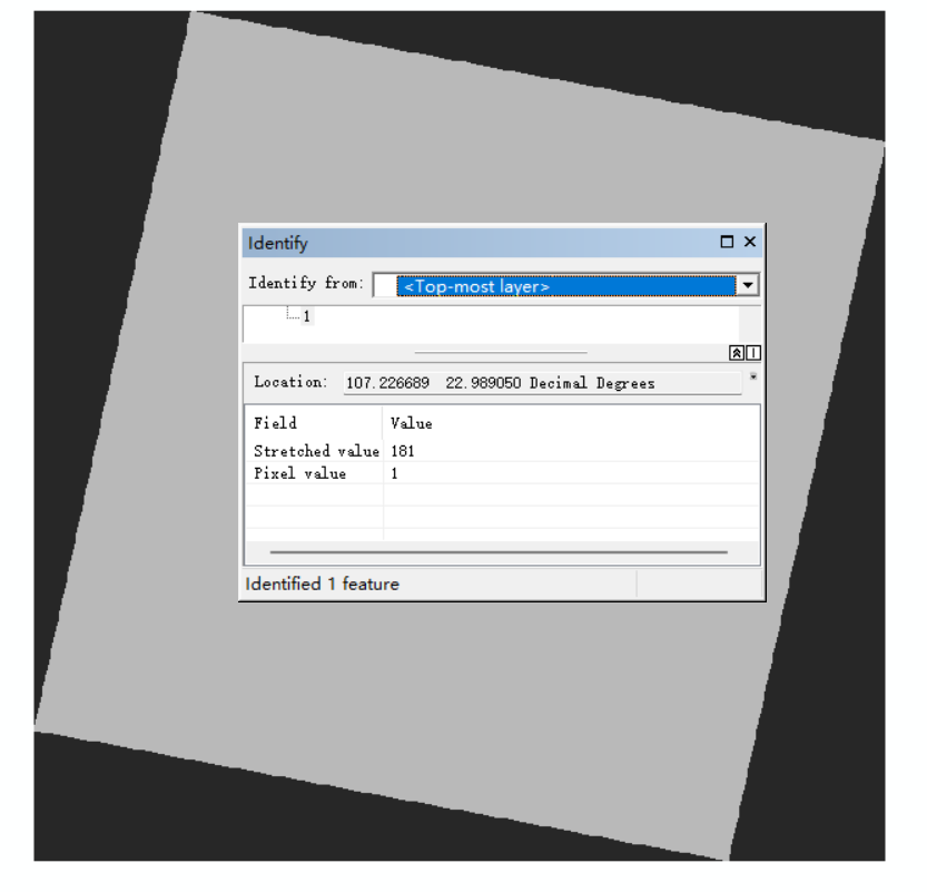
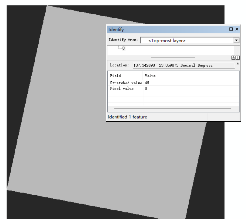
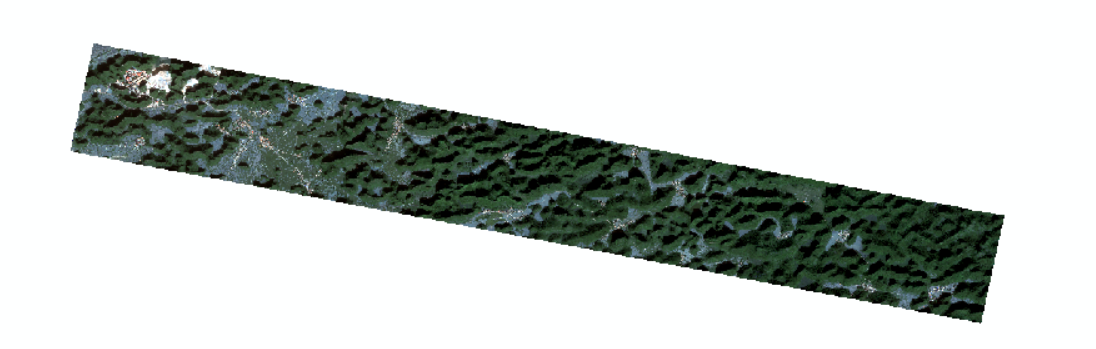
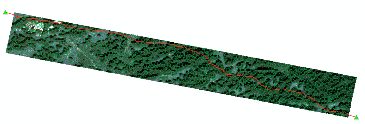
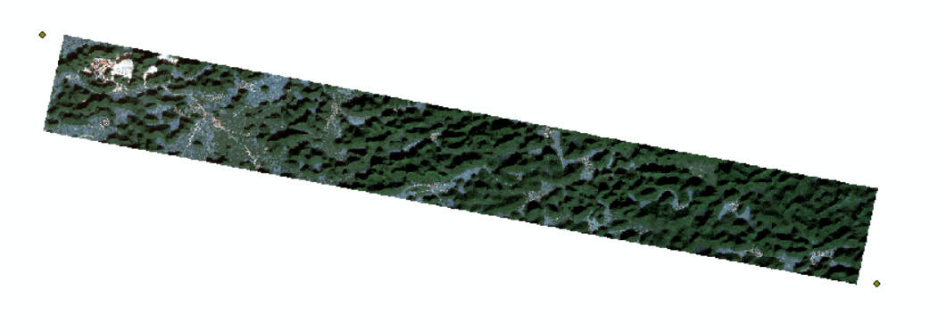 这里可能有人问了,为什么角点不是在影像边缘。其实实际上影像整体范围是这样的:
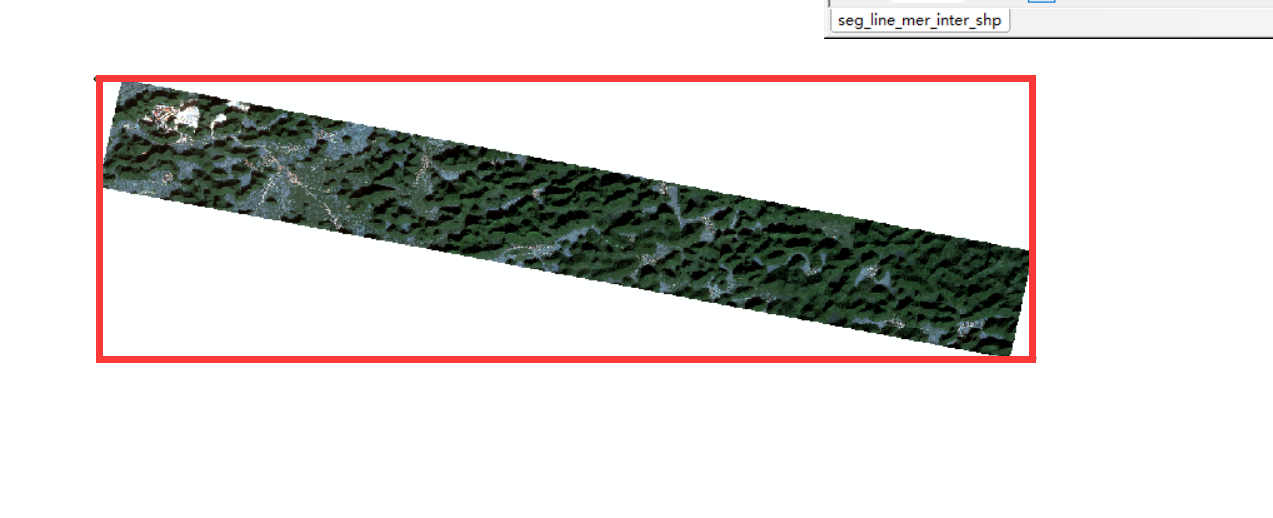 只是因为arcmap的忽略背景值设置,使得图像显示背景被忽略了。